Cartographer and Surveyor
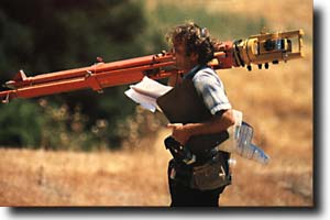
Cartographer and Surveyor Cartographers generate geographic, political, and cultural information and measure and map the earths surface. The maps they create can contain everything from latitude, longitude, and altitude to political affiliations, population density, and water use. A Surveyor establishes boundaries, measures land parcels, and describe them for legal documents. As a high school student preparing to go into surveying and cartography you should take algebra, geometry, trigonometry, drafting, mechanical drawing, and computer science. A 4 year college degree is becoming more important as you apply for one of these positions. A BS is preferable but you can also take a 1-3 year program at a community college, technical, or vocational school. If you were to get your degree at the University of Florida you could expect to take Calculus I , II, and III, Statistics, Linear Algebra, and Physics I . To get your license to practice in this field you might also have to take a written test and many states are now requiring that you have a Bachelors in surveying or something similar (such as Civil Engineering) in combination with a written test and experience to become licensed. Most Cartographers and Surveyors make between 65,000 a year (in 2000) and are employed by an Engineering or Architectural firm.
Local Companies
Additional Links
|
Advertisement